F F line, San Francisco metro
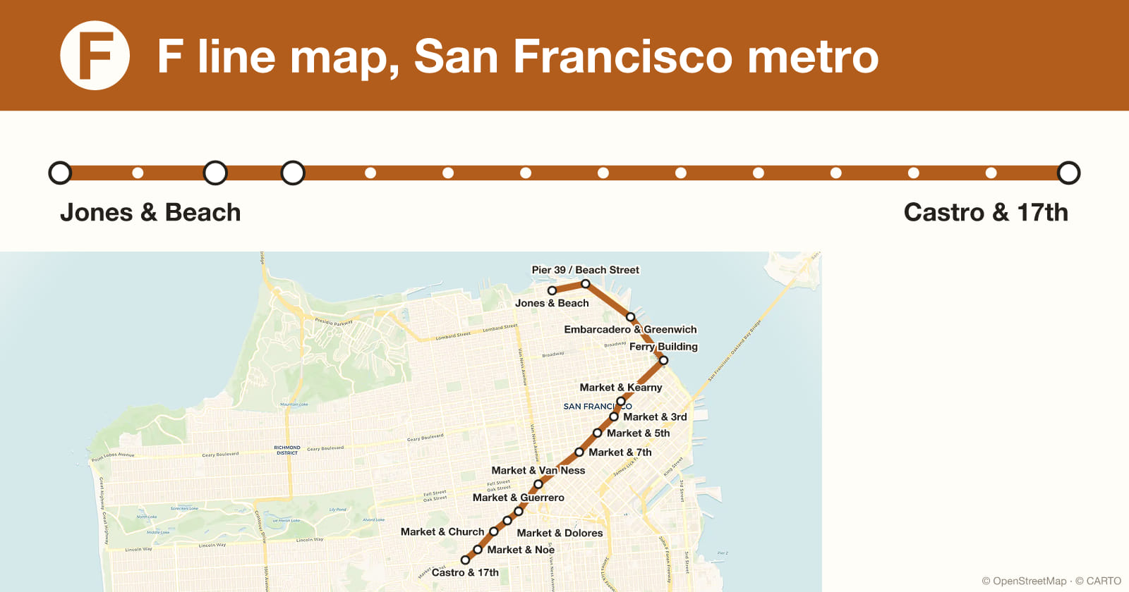
Looking for a map of the F line on the San Francisco metro? It serves 14 stations over roughly 7.9 km. It runs between Jones & Beach and Castro & 17th. This page gathers its route, its stations in running order and its interchanges.
Show moreShow less
2 of its stations interchange with another line. For the record, its oldest station is Castro & 17th (1995), its busiest is Ferry Building (1,400,000 passengers a year) and its best connected is Embarcadero & Greenwich (2 lines).
Want to know how well you really know it? DailyMetro asks you to guess one San Francisco metro station every day, with clues for line, direction and distance. Explore the whole network for the other lines and every station.
Key facts
- Number of stations14
- TerminiJones & Beach · Castro & 17th
- Oldest stationCastro & 17th · 1995
- Route length≈ 7.9 km
- Busiest stationFerry Building
- InterchangesE
Length estimated from station coordinates, accurate to a few hundred metres.
When each stop on line F opened
Every station on its real position, coloured by the year it opened and sized by annual ridership. The drawing assembles itself in opening order.
Interchanges on the F line
All 14 stations in order
- 1Jones & Beachterminus
- 2Pier 39 / Beach Street
- 3Embarcadero & Greenwich E
- 4Ferry Building E
- 5Market & Kearny
- 6Market & 3rd
- 7Market & 5th
- 8Market & 7th
- 9Market & Van Ness
- 10Market & Guerrero
- 11Market & Dolores
- 12Market & Church
- 13Market & Noe
- 14Castro & 17thterminus
Frequently asked questions
- How many stations are on the F line?
- The F line on the San Francisco metro serves 14 stations.
- What are the termini of the F line?
- The F line terminates at Jones & Beach and Castro & 17th.
- What is the oldest station on the F line?
- The oldest station still served by the F line entered service in 1995.
- What is the busiest station on the F line?
- Ferry Building, with roughly 1,400,000 passengers a year.
- How long is the F line?
- The F line runs for roughly 7.9 km.
- Which lines does the F line connect with?
- The F line meets the E lines.